Faridpur is a district in central Bangladesh. It is a part of the Dhaka Division. Faridpur District has a population of over 1.7 million people and is situated on the banks of the Padma river (Lower Ganges). It is bordered by Madaripur, Narail, Rajbari, Magura, Shariatpur, Gopalgonj, Dhaka and Manikganj. Once a subdivision, the original area of the district comprised what is today the Greater Faridpur region which includes the present day districts of Rajbari, Gopalgonj, Madaripur, Shariatpur and Faridpur.
Famous for its jute fields, which are considered to produce the finest raw jute, and aristocratic zamindar families, the district was a focal point for political movements in Bengal during the British Raj and the early days of the Pakistan era. It produced some of the most prominent politicians and cultural figures of Bengal.
Geography
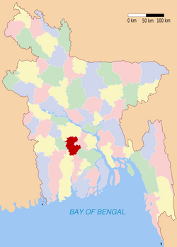
Faridpur is located in central Bangladesh under Dhaka division. The area of this district is 2072.72 km². The district is bounded by the Padma river to the north and east and across the river are Manikganj, Dhaka and Munshiganj districts. It is bordered by Madaripur to the east, Gopalgonj to the south and Rajbari, Narail and Magura to the west.
The soil is highly fertile as the district lies on the banks of the mighty Padma river, also called the Lower Ganges. Other smaller rivers include Old Kumar, Arial khan, Gorai, Chandana, Bhubanshwar and Modhumoti. The main depressions are Dhol Samudra, Beel Ramkeli, Shakuner Beel and Ghoradar Beel.
History
In 1582 in the reign of Emperor Akbar, the province of Bengal was formed into 33 sarkars or financial sub-divisions, and Faridpur area appears to have been included with in the sarkar of Muhammad Abud. During the Emperor Shah Jahan, these divisions were carried onto such an extent as to cause in a falling of the imperial revenue. In 1721 a new partition of the country was made the province of Bengal being formed into 13 large divisions (chaklas) instead of sarkars. In 1765 the financial administration of Faridpur, together with the rest of Bangal was captured by the English, and in 1790 the criminal administration of the country at the correctors were invested with magisterial powers. In 1793 the collectors were relieved of their magisterial duties and separate officers were appointed united Judicial and Magisterial power together. The greater portion of Faridpur was then comprised within Dacca Jalalpur. In 1811 Faridpur was separated from Dacca collectorate.
The district was initially known as Fatehabad. In 1860 the district was named as Faridpur after 12th Century Sufi saint Shah Sheikh Fariduddin. Faridpur town was declared a municipality in 1862 and a District Prison was set up in 1865. In 1840 the Faridpur Zila School was established and is one of the oldest schools in modern day Bangladesh.
The original district stretched out across central Bengal, comprising what is, today, the Greater Faridpur region. A politically important district during the British Raj, Faridpur became a sub-division of Dhaka Division after the creation of Pakistan. In 1984, with the Decentralization Program of the Bangladesh government, Faridpur district was broken into five separate districts: Rajbari, Gopalgonj, Madaripur, Shariatpur and Faridpur.
Faridpur is notable for its rich zamindari history. Most of the zamindar families were Hindus. They included the Basu Roys of Gopalgonj, the Basu Roy Chowdhurys of Ulpur (Shahapur), the Sikdars of Kanaipur, The Bhawal Rajas of Pangsha, the Senguptas(dewanji)of dhamaron , the Lords of Choddo and Baish Roshi estates of Bhanga. During the reign of the Nawabs of Bengal, several Muslim zamindaris were established. They included the Chanpur Estate and the Boalmari Estate in present day Faridpur, Golam Ali Chowdhury of Idilpur pargana and the Padamdi Nawab Estate in present day Rajbari. The most powerful Muslim landlords were Nawab Abdul Latif and Chowdhury Moyezuddin Biwshash.
The history of all the zamindars couldn't been found except of the SIkdars of Kanaipur and Chowdhury Family of Haroa Chowdhury State Belgachi.
The Chowdhury family of Belgachi Haroa State
zaminder Khan BahadurYusuf Hossain Chowdhury and zaminder Khan Bahadur Alimuzzaman Chowdhury .
The Syeds of Modhukhali
Modhukhali Upozilla under Faridpur District
Barrister Syed Kamrul Islam Mohommod Salehuddin(S.K.I.M.Salehuddin,commonly Known as Barrister Salehuddin,1937–1983):
Barrister Salehuddin Born in Gopalgonj in 1937.His Father was Syed Mohommod Abdul Halim and Mother Saleha Khatun.He was a Member of the Honorable society of the Inner temple(London) and he was Called to the bar from the same society in 1968.He was a Queens Councellor(QC) in England.He was a member of the British Civil Service in England.elected Pakistan National Assembly Member(MNA)from Boalmari Upozilla under Faridpur District in 1970 from Awami League.In 25 March 1971 he Uphold the Flag of Bangladesh infront of Boalmari Rest House(Dakbanglaw)in a public Meeting. After Independence Barrister Syed Kamrul Islam Mohommod Salehuddin acted as a Constituent Assembly Member (1972) and signed the First Constitution (1972) of Bangladesh. Barrister Syed Kamrul Islam Mohommod Salehuddin elected as an Independent Parliament Member(MP)at the First National Election in 1973 from the Boalmari-Alfadanga-Baliakandi area under Faridpur District. He was a Parliamentarian-Constitution Expert and a great politician of the country. He was a follower of the Father of the Nation Bangabandhu Shaikh Mujibur Rahman and Moulana Abdul Hamid Khan Bhasani. Barrister Salehuddin formed Bangladesh Justice Party in 1981. Former President H.M.Earshad divided the Boalmari Upozilla and created a new Upozilla named "Modhukhali". The original home village of Barrister Salehuddin named Bonomalidia now situated at Modhukhali upozella. Barrister Salehuddin died in 24 May 1983, in Dhaka. He was buried in Banani Graveyeard, Dhaka.
Syed Mohommod Abdul Halim(1912–1999) was a civil servant in the Bengal Civil Service(BCS), he was a vice president of undivided Bengal Student Association. He wrote the original Memorandum during the partition in 1947 to include the Greater Khulna District in Pakistan with assistance from Sher-E-Bangla, A.K.Fazlul Haq, Hossain Shahid Sarwardhy, Khan A.Sabur (Sabur Khan of Khulna), M.A.Majid Advocate. He was awarded TQA by the Pakistani Government. He rejected this TQA title during the War of Libaration in 1971. His elder son Barrister Syed Kamrul Islam Mohommod Salehuddin was a Politician of Bangladesh.
Professor Dr.Syed Safiullah Scientist and a professor of Chemistry, Jahangirnagar University, Saver, Dhaka, Bangladesh. He was Secretary General of IIESDM. He completed his PhD at London university. He awarded third World academy of science Prize from Italy. He is a Fellow of Royel College of Chemistry(FRCC),UK. His Father Syed Mohommod Abdul halim and Mother Saleha Khatun.
Dr.Syed Zaved Mohommod Salehuddin(1972-__ ) Dr S.Z.M.Salehuddin was born in 04/02/1972. His father Politician Barrister Syed Kamrul Islam Mohommod Salehuddin was a prominent political leader of the country and his Mother is Dilafroze Begum.Dr.Syed Zaved Mohommod Salehuddin did his M.S.S.(Political science) from Dhaka University in 1993.He did his LL-B. from the same university under Central Law College.He Received His M.Phil. Degree in 2000 and Phd in 2006 under Dhaka University.He Started his carier as an advocate in 1998.He is an active member of servel National and International Organization like,viz.Bangladesh Supreme Court Bar Association,Dhaka Bar Association,Asiatic Society,Bangladesh,Transparency International,Bangladesh(TIB),Lions Club International,Barrister Salehuddin Trust,Barrister Salehuddin Smriti Sangshad.He was a former teacher of Public Administration Department,Jahangirnagar University,Saver,Dhaka,Bangladesh.
The Sikdars of Kanaipur: They rose to power mostly under the lady zamindar Bhabatarini Sikdar, a widow who was an efficient ruler of her times and was very famous in dealing with her business-mind and conducted trading on river throughout India and brought back enormous wealth to her estate. Her only son Satish Chandra Sikdar was also efficient in looking after the estate but was more famous for his arrogance and shrewdness that he used to rule his subjects. His two sons of different wives were Surendranath Sikdar and Nirodboron Sikdar were latter the rulers of the divided estate though majority of the property going under Surendranath Sikdar being the elder son. He and his wife Radha Rani Sikdar, a daughter of a zamindar of Kalighat in Calcutta had six children, among them the eldest and the only daughter Arati Sikdar, Shukho Surjo Sikdar, Nihar Ranjan Sikdar, Timir Boron Sikdar, Dilip sikdar and Basudeb Sikdar. Surndranath sikdar had an early life, thus the estate came under Radha Rani Sikdar as his elder son became an aesthatic, her second son went to Calcutta to become an automobile engineer who later married to Pushpa Rani Sikdar and settled in Calcutta and took no interest in zamandari affairs but officially was the owner of the estate being the second married son and the other sons were both incapable and inefficient to run the estate and thus lossing the vast property to the Government. Till the death of Radha Rani Sikdar the estate was looked and maintained properly by herself.
During the 1800s, Haji Shariatullah, after returning from Mecca, began the famous Faraizi movement aimed at ending the persecution of Muslims by upper caste Hindu zamindars. The Indigo Resistance Movement which resisted Indigo plantations promoted by the British East India Company, also began in Faridpur. The movement was led by Pir Dudu Miah.
The Greater Faridpur region is also famous for producing some of the finest politicians of the Indian Subcontinent. They include Baba Ambika Charan Majumder, Maulvi Tamizuddin Khan, Bangabandhu Sheikh Mujibur Rahman, Mohonmiah Yusuf Ali Chowdhury , Buddhadeb Bhattacharya , Humayun Kabir and many more.
Faridpur hosted several key meetings of the Indian Independence movement. It was regularly visited by Subhash Chandra Bose, Chittaranjan Das, Rabindranath Tagore, and Maulana Abul Kalam Azad. The annual conference of the Bengal Congress held on the grounds of the Moyez Manzil Palace in Faridpur in 1921 was attended by Mahatma Gandhi.
After the creation of Pakistan, Bengali nationalists frequently held large rallies in Faridpur. Huseyn Shaheed Suhrawardy and Sher-e-Bangla A. K. Fazlul Huq would regularly visit the district. Prior to the elections of 1954 which brought Bengali nationalists to power in Faridpur, the Jukta Front coalition held a massive rally on the grounds of the Biwshash Bari zamindar mansion in the village of Chanpur, just outside Faridpur. The rally was attended by Huseyn Shaheed Suhrawardy, Maulana Abdul Hamid Khan Bhashani and Sher-e-Bangla A. K. Fazlul Huq.
Faridpur also saw many ruthless atrocities during the Bangladesh Liberation War. On April 26, the Pakistan army landed on Daulatdia river port (now in present day Rajbari) and began a massacre as soldiers went from village to village killing sleeping civilians during dawn.
Demographics
Faridpur has a population of 1,714,496 people according to the 2001 census. 50.55% of the people are male and 49.23% are female. The major religions are Islam and Hinduism. 88% of people are Muslims in the district. Although once a Hindu dominated district, after the partition of India, Hinduism has significantly declined with only 11% of the population being Hindu in Faridpur due to the ethnic cleansing by the Pakistani military and Rajakars (Bengali collaborators of Pakistan) before the independence of Bangladesh. The major ethnic group are the Bengali people, as is the case in most of Bangladesh. There is also a small Bihari and Oriya population.
Religious institution Mosques 3516, temples 251, Buddhist temples 21, churches 36.
Administration
Faridpur district consists of 9 upazilas, 4 municipalities, 79 union parishads, 36 wards, 92 mahallas and 1859 villages. The town consists of 9 wards and 35 mahallas. The area of the town is 20.23 km². The population of the town is 99634; male 51.73%, female 48.27%. The density of population is 4925 per km². The literacy rate among the town people is 66.6%. The town has two dakbungalows.
Faridpur district is divided into the following upazilas:
- Faridpur Sadar Upazila
- Boalmari Upazila
- Alfadanga Upazila
- Madhukhali Upazila
- Bhanga Upazila
- Nagarkanda Upazila
- Charbhadrasan Upazila
- Sadarpur Upazila
- Shaltha Upazila
Economy
The district has mainly aggro-based economy. The main crops are jute and paddy. Other crops include peanut, wheat, oilseed, pulse, turmeric, onion, garlic and coriander. Many fruits are also produced, notably mango, jack fruit, blackberry, palm, coconut, betel nut, kul, tetul, bel, papaya, banana, and guava. The main exports are jute, Helsa fish and sugarcane.
Faridpur is famous for producing high quality raw jute. Once the principal earner of the country's economy, the jute industry has suffered a decline in recent years due to low prices on the international market, leading to many jute plants shutting down. However, Faridpur still has quite a few which are also some of the most prominent. They include notably Faridpur Jute Fibers and Sharif Jute Mills.
The district, being on the banks of the Padma, also accounts for a significant portion of exports of Helsa fish. The Helsa found in Padma are immensely popular at home and abroad and are called the Silver Helsa. The district has thriving fisheries and a growing poultry industry.
Manufacturing is moderate in the district although there are several industries. Kanaipur Industrial Area was set up in Faridpur town during late 1980s. There are many sugar mills and jute plants as well. Some of the leading industries of the district are listen below:
- Faridpur Jute Fibers
- Pride Jute Mills
- Aziz Jute Fibers
- Aziz Pipes
- Faridpur Sugar Mills
- Khankhanapur Textile Mill
- Saiyed Jute Spinning
- Karim Jute Mill
- Faridpur Cold Storage
- Sharif Jute Mill
- BADC Cold Storage
- Rokeya Textile
- A H Jute Mills
In 2009, the Bangladesh government announced plans to construct the long demanded Padma Multipurpose Bridge. When completed in 2012, it will be the longest bridge in South Asia. The Padma bridge will greatly help in developing the Greater Faridpur region as it would connect Dhaka with the districts.
Places of interest
- Kobi Jasimuddin's House: Residence of the renonwed Bengali poet Jasimuddin
- Faridpur District Court: 19th century colonial styled court house
- Mazar of Dewan Saker Shah: Mausoleum of the Dewan of the Boalmari Estate
- River Research Institute: a government research institute
- Moyez Manzil Palace: a mansion of the Chanpur Estate
- Baisrashi Babu Bari Palace: a mansion of the Baisrashi Estate
- Kamlapur, Faridpur: historic neighbourhood housing colonial buildings and zamindar mansions
- Dighir Par Masjid: a mosque in Bhanga built during the Mughal era
- Basudeva Mandir: famous Hindu temple
- Faridpur Zila School: one of the oldest schools in Bangladesh
- Bishwa Zaker Monjil : a mansion of the Aatroshi Estate
- Gerda Shaheb Para a beutifull place.(by md. rasal)
 |
| Tomb of Bengali poet Jasimuddin |
 |
| House of Bengali poet Jasimuddin |
Personalities
- Bangabandhu Sheikh Mujibur Rahman : Founder of Bangladeh.
- Jasim Uddin: Country's only pastoral poet
- Munsi Muhammad Abdur Rouf: Bir Shrestho (valiant war hero of 1971)
- Ambika Charan Majumder: President of the Indian National Congress (1916–1917)
- Nawab Abdul Latif: renowned Muslim educator and social reformer during the 19th Century
- Chowdhury Moyezuddin Biwshash: renowned zamindar, politician and social reformer during the 19th Century
- Humayun Kabir: eminent Indian politician, educationist and former adviser to the Government of India under Jawaharlal Nehru
- Buddhadeb Bhattacharya: Chief Minister of West Bengal
- Mohonmiah Yusuf Ali Chowdhury : Eminent Muslim League politician
- Chowdhury Abdallah Zaheeruddin: Former Central Minister of Labor, Federal Government of Pakistan.
- Chowdhury Kamal Ibne Yusuf: Ex- Minister Govt. of Bangladesh, Vice-President of the Bangladesh Nationalist Party (BNP)
- Alamgir M. A. Kabir: Former Advisor to the Caretaker Government of Bangladesh, Former Inspector-General of Police & recipient of Independence Day Award
- Akber Kabir: Former Advisor to the Government of Bangladesh under President Ziaur Rahman & renowned philanthropist
- Fakir Alamgir: Popular folk singer
- Geeta Dutt: Indian playback singer
- Sigma Huda: human rights activist, former United Nations Special Rapporteur on human trafficking
- Khushi Kabir: Co-ordinator of Non-Government Organization, Nijera Kori & social activist
- Babar Kabir: renowned environmentalist